

Airspace, Airport and NOTAM Details
Tap anything on the map to open its details in a panel: on the right on a computer, from the bottom on a phone.
Airspaces
When you tap the map, the panel lists every airspace at that spot, one card each. The header shows how many are selected, the UTC time and the position.
Each card shows the type, name, class and vertical limits, plus one status badge. Open a card to see the FIR and country, frequencies, remarks and, with Live, when the airspace is active.
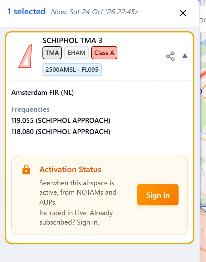
- Use the arrow keys, or tap the map again, to move through the cards. The current card is highlighted on the map.
- The share button on a card copies a link that opens the same airspace.
Status badges (Live)
The badge says what the map shows for your Activity range:
| Badge | Meaning |
|---|---|
| Active today | Activated today by a NOTAM or an AUP/UUP |
| Active | Active from its published schedule |
| Upcoming | Becomes active later today |
| No activity today | No activation found for the rest of today |
| Deactivated | A NOTAM deactivates the airspace |
| Unknown | The status could not be worked out |
When you pick another range, the words follow it, for example Active tomorrow or Not active this weekend. An airspace that is always active gets no badge.
Activation (Live)
The Activation section is the airspace's activation calendar: it shows when the airspace is active, day by day. Choose Map range (your Activity range), Today or All.
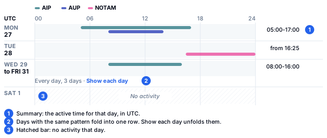
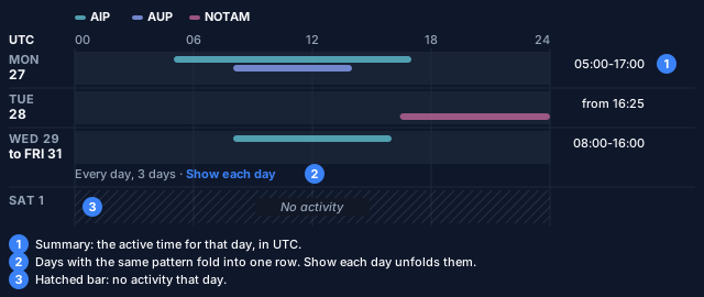
- Each day is a row on a UTC scale from 00 to 24, with a lane for each source: AIP (published schedule), AUP and NOTAM.
- The summary on each row reads like
05:00-17:00,from 16:25,All day,UnknownorDeactivated. - Days that are the same fold into one row, such as "Every day, 3 days". Tap Show each day to unfold them.
- Days without activity show as a hatched bar labelled No activity.
- Tap a day to select it. The Sources section below then lists the AUP entries and NOTAMs for that day. Sources for other days sit under Outside this view.
Without Live, this section shows Activation Status with a short note that it is included in Live.
Graphical NOTAM areas
A graphical NOTAM opens like an airspace, with the full NOTAM text in its card.
Airports
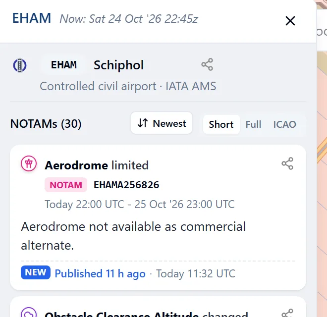
Tap an airport to see:
- its ICAO code, name and type, IATA code, city and country;
- a status line when it is closed, closed at times, permanently closed or for emergency use only;
- NOTAMs, the airport's NOTAMs in your Activity range;
- Nearby point NOTAMs, NOTAMs without an area close to the airport.
The share button copies a link to the airport.
NOTAMs
Tap a point NOTAM icon to open the NOTAM. If several NOTAMs share the spot, the panel lists them all.
Every NOTAM list has two controls:
- Short, Full and ICAO switch between a short summary, the full text and the original ICAO format.
- The sort menu offers Newest first (by publication time), Valid from (earliest start first) and Group by subject.
To learn how to read the original format, see How to read a NOTAM.
Marks (Live)
Open a NOTAM's ⋯ menu and choose Mark as read, Mark important or Hide from my lists. On a touch screen, swipe a NOTAM card right to mark it read, or left to hide it.
- A read NOTAM dims and keeps a Read tag. An important one gets a flag.
- Hidden NOTAMs move to Hidden by you at the end of the list. Choose Show again to bring one back.
- A mark belongs to one NOTAM number. A replacing NOTAM (NOTAMR) arrives unmarked, and a mark ends with its NOTAM.
- Marks are kept on this device, for your account.
Without Live, the marks show faded in the menu, and choosing one explains that they come with Live.
Locations
Search for a coordinate to open a Location panel. It shows the airspaces at that point, the nearest airports, the elevation, sunrise, sunset and civil twilight, and the position in other formats. Share location copies a link to it.
Close the panel
Press Esc, use the close button, or use your browser's back button.